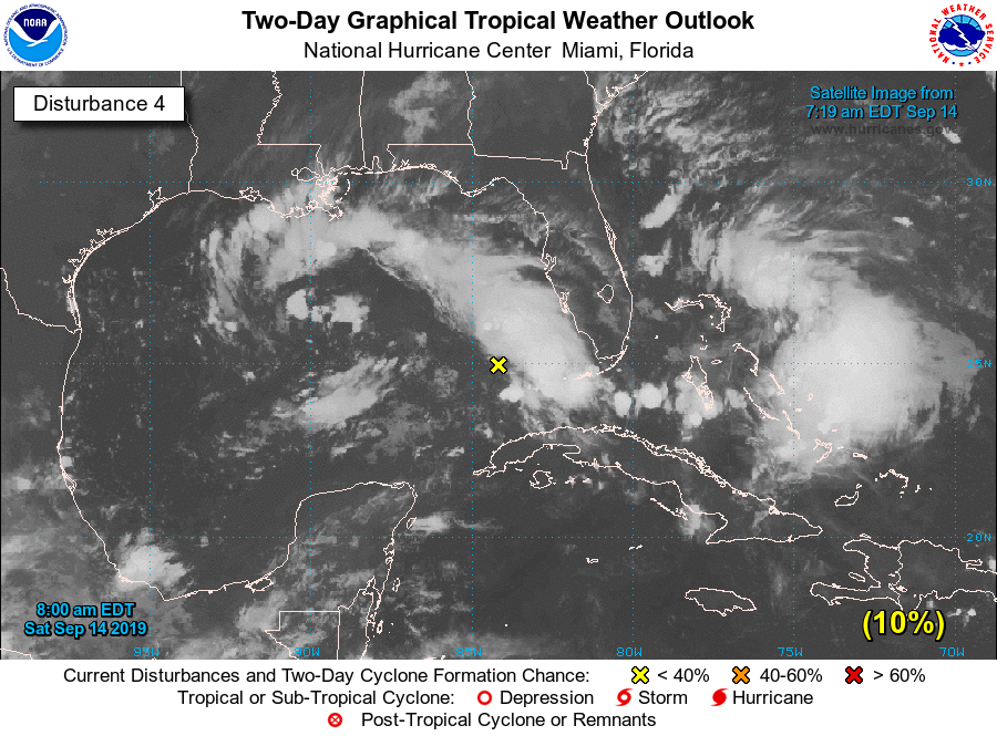
Some readers may note that the National Hurricane Center has begun tracking an upper-level low pressure system over the eastern Gulf of Mexico (note, this is distinct from Tropical Storm Humberto).…
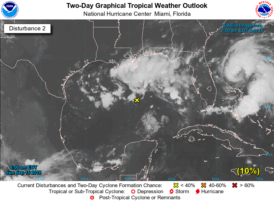
A broad area of disorganized showers and thunderstorms continues to move westward across the Gulf of Mexico, and should push into the Texas coast late on Monday or early Tuesday, based upon present…
I’m no forecaster, but I’ve never seen tropical and forecast combined in Houston to only be 1” of rain. Can we expect the usual southeast TX feast or famine tropical downpours?
I’m no forecaster, but I’ve never seen tropical and forecast combined in Houston to only be 1” of rain. Can we expect the usual southeast TX feast or famine tropical downpours?
Sent from my iPhone using Tapatalk
Fingers crossed for famine. I can live with an inch. I’m right in that red area.
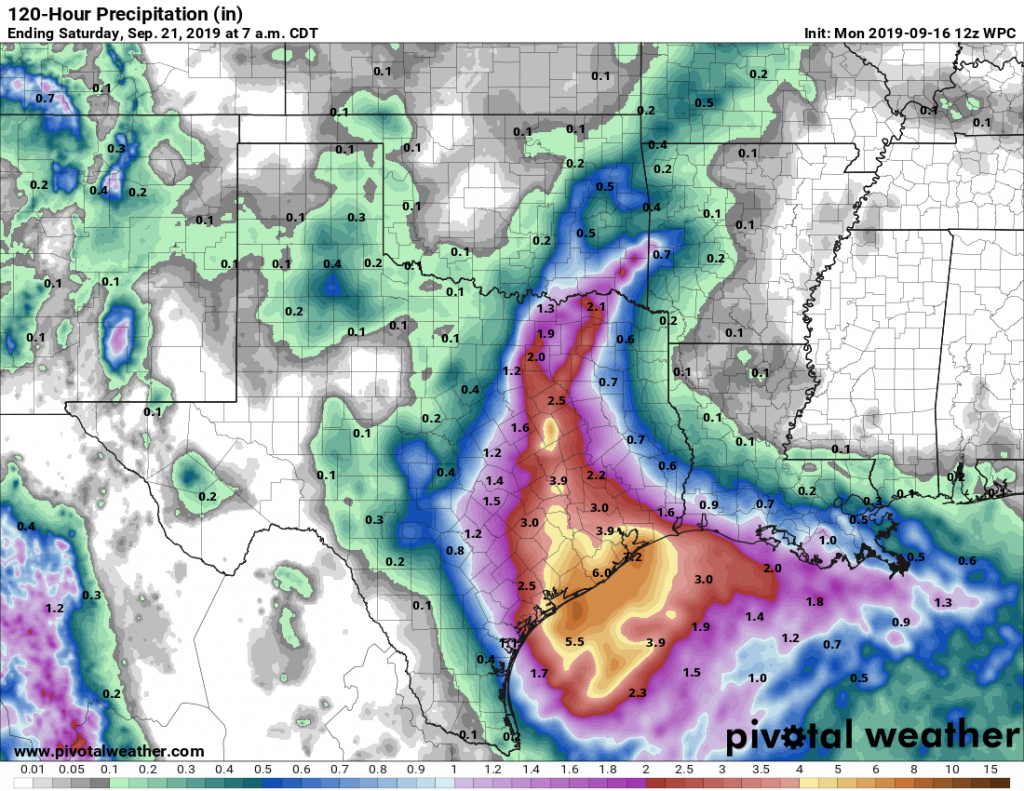
The big weather story for our week will be a slow-moving tropical system pushing into Texas beginning late Monday, and bringing the potential for heavy rainfall from Tuesday through Thursday. It st…
The big weather story for our week will be a slow-moving tropical system pushing into Texas beginning late Monday, and bringing the potential for heavy rainfall from Tuesday through Thursday. It st…
Sent from my iPhone using Tapatalk
Been watching this thing the last few days, Im in the red area also and would love to get about 1-2 inches everyday the next 4 days, it’s dry as heck around here.
Models definitely have gotten more aggressive over yesterday & last night. First the Canadian & ICON were showing some impressive rain fall totals, then the Euro jumped on board yesterday, and especially overnight. The GFS had been consistently not jumping on board, until overnight where it now it now is also starting to follow suit in showing some higher rain totals. Additionally, some models are spinning this up into a depression, or possibly even a Tropical Storm before fully coming ashore. Models really slam on the breaks once this all starts to hit the coast, and a lot of the higher totals are later in the week with Wednesday & Thursday being when the most impact is made. Problem with set ups like this, is these models are showing the potential for some very high rain totals, but knowing exactly where these amounts will be isn't known.
Added the Weather Prediction Center 5 Day QPF. This is a lot more reliable(but also more conservative) in my opinion than taking individual model predictions.
Been watching this thing the last few days, Im in the red area also and would love to get about 1-2 inches everyday the next 4 days, it’s dry as heck around here.
Same boat. But what are the odds we actually get what we need? I have a feeling its going to be more than we want. Its about that time of year to get a **** floater
Same boat. But what are the odds we actually get what we need? I have a feeling its going to be more than we want. Its about that time of year to get a **** floater
That's how I feel. I'd rather it not rain at all than flood.


Comment